Hiking and Walking in Sault Ste. Marie
Rugged trekking or just walking your dog…Sault Ste. Marie and Algoma is the hiking destination for you.
From city and park trails to wilderness paths, anyone who laces up their sneakers will find the perfect path. Sault Ste. Marie proper offers manicured paths to wilderness trails. Just beyond the city, you’re 5 minutes into forest and and 30 minutes to coastal hikes. You can walk the paved John Rowswell Hub Trail in the city itself, with 7 distinct sections from urban to wetland, two of which are directly accessible from the Inn. Hiawatha Highlands, a 3,000-hectare conservation area within the city, has 50km./(31mi.) of hiking trails meandering through ancient pines and cascading waterfalls. Beyond the city, there are provincial parks and Lake Superior coastline trails to explore. One kilometre or 30 kilometres…our Adventure Hosts can help you plan the perfect walkabout for your level and interest. Read more about area trails…
The Inn supports your Hiking/Walking adventure:
- Indoor storage – You can secure any bulky outdoor gear in the Inn’s garage.
- Inn Packages – Combine your adventure with a stay at the Inn and enjoy the pools and whirlpools of Club Cabana Aqua Spa after your day’s adventure. Learn more.
- Lunch to Go – The Inn’s kitchen will create a hearty and healthy boxed lunch for you to enjoy.
- Adventure Hosts – Consult with an Adventure Host for activity assistance.
Or call 1-888-461-7077 for more information on packages, adventures and more.
City Walking and Hiking Trails
The John Rowswell Hub Trail
The Hub Trail is restricted to walking and other self-propelled activities such as cycling. It connects historical, cultural and natural points in Sault Ste. Marie, Ontario and engages the user with its mix of urban areas and nature-significant areas. The Hub Trail incorporates a paved trail combined with a few short stretches of designated street. The entire distance is 25 km./15.5mi., but there are 7 sections with different access points. The north and east sections are directly accessible from The Water Tower Inn. Users can snack in picnic areas or enjoy a rest on park benches. In its more urban neighbourhoods like the downtown waterfront boardwalk, you can access restaurants, bars, and destinations like the Bushplane Museum or the Art Gallery of Algoma, among others. The Inn’s Adventure Hosts can give you a map and recommend the right section for your hike or walk.
Parks Canada Canal Historic Site – The Soo Locks
This trail system is a walk through thousands of years of history. You can access both the Whitefish Island and the Attikamek trails, and also walk the park grounds of this significant heritage area. The area can be accessed from the waterfront boardwalk. Whitefish, an island in the St. Mary’s River, was an ancestral fishing station to the Anishenabek people of the Great Lakes for over 2,000 years and is in their stewardship still. At the park’s Visitors’ Centre, you can learn about the deep history of this area as well as gain an understanding of how the locks work and even watch as boats pass through the system. You access the trails by crossing the lock gate bridge over the Canadian Canal, built in 1897, and now used only for recreational vessels. You can also walk out along a very long pier to view Lake Superior. The trails here meander among wetlands and streams often dammed by busy beavers. There is much birdlife to view, and there are lookout platforms along the way. Overhead, the Sault Ste. Marie International Bridge spans the twin Saults. At one point you skirt the roaring rapids of the St. Mary’s River. If you explore all the paths and viewpoints, you can work your way up to a 10km hike.
Bellevue Park
A tranquil green space on the St. Mary’s River east of downtown Sault Ste. Marie, this 42-acre park provides a great view of the Great Lakes freighter traffic using the Soo Canal system. This is an easy 2.4 km. walk on paved trail and the dirt path that circles Topsail Island. There are bridges, a duck pond, and botanical gardens and a visitor’s greenhouse. You’ll see the fenced grave near the pond, that of Colonel John Prince (1796-1870), who built a house there and called it Bellevue. You can get drive directions and a map from one of our Adventure Hosts.
Hiawatha Highlands
Escape from the city within the city limits. Towering pines, rugged rocks, and sparkling creeks and waterfalls punctuate this incredible trail system. A network of nordic ski trails crisscross this 3000-acre conservation area, open for walking and hiking during the summer months. You can drive directly to the large pond/beach area, then climb the stairs alongside the cascades of Crystal Creek. Sit on a rock and dangle your feet in one of the still pools. You can walk the easy 2km trail (a choice for families) and return to the picnic/playground area. Or tackle one or more of the 5km ski trails. The trailhead is just a 5-minute drive from the Inn. Our Adventure Hosts can provide you with detailed trail information.

Wilderness Walking/Hiking beyond Sault Ste. Marie
Robertson Cliffs Trail
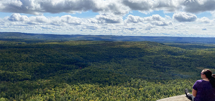
This 5km hike has it all…cliff-top views, beautiful forest trail, and a waterfall. It’s a favourite hike amongst locals. It’s located about 25 minutes north of the Inn. The cliffs are 150m high and located on the northern side of the Goulais River Valley. These cliffs have been home to a peregrine falcon re-nesting project. An Adventure Host can give you all the info you need to enjoy this special hike.
Pancake Bay Provincial Park
There are two trails you can hike here:
- The Pancake Bay Nature Trail… a shoreline and lowland walk of 3.5 km.
- The Lookout Trail…a moderate 14km to the outlook and back. Two lookout platforms offer spectacular views of Lake Superior and Pancake Bay.
Pancake is a 65 km/40 mi drive from the The Water Tower Inn. Our Adventure Hosts can assist you with maps and information. You can also visit www.ontarioparks.com/park/pancakebay. After a day in the park, stop at Agawa Crafts at Pancake Bay, a famous traveller stop along the way, buy some smoked lake fish, and enjoy an ice-cream cone.
Lake Superior Provincial Park
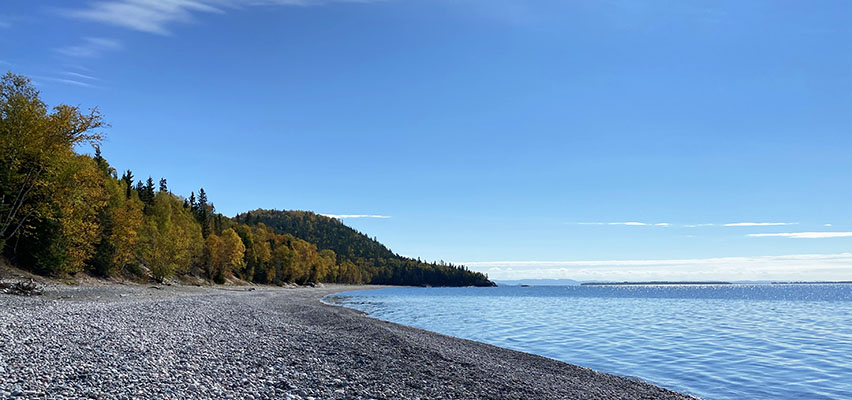
Lake Superior Provincial Park (LLSP) is one of the largest provincial parks in Ontario, covering about 1,550 square kilometres (600 sq. mi.) along the northeastern shores of Lake Superior between Wawa and Sault Ste. Marie, in Algoma District. True to its namesake, it follows the coast of the world’s largest lake, but also encompasses many watershed rivers and inland lakes. There are 11 marked trails for all levels of hiker, and many sites of special interest; for instance, the Agawa Rock Pictographs, a sacred site where generations of Ojibwe have come to record dreams, visions and events. The Orphan Lake Trail is an Inn favourite with a picnic stop at the falls of the Baldhead River, and the sun-warmed cobblestone beach at the river mouth. Our Adventure Hosts can provide you with maps and tips for hiking LSPP. You can also visit www.lakesuperiorpark.ca for an excellent overview of park facilities and trail descriptions. The park is a 2-hour drive from the Inn, but so worth the journey just for the vistas of Lake Superior enroute.

Or call 1-888-461-7077 for more information on packages, adventures and more.